The Grand Caillou/Dulac Band of Biloxi Chitimacha Choctaw Tribe has been losing land to the sea, which could hamper efforts to gain federal recognition.
|
Listen To This Story
 |
Growing up in southern Louisiana, Devon Parfait watched as members of his community, the Grand Caillou/Dulac Band of Biloxi Chitimacha Choctaw (GCDBCC), moved from their lands as flooding and saltwater intrusion degraded nearby estuaries. Now, as chief of the GCDBCC Tribe and a coastal resilience analyst at the Environmental Defense Fund, he’s analyzing that land loss to bring more resources to his tribe.
While an undergraduate at Williams College, Parfait led research showing that many of the land parcels allotted to GCDBCC ancestors from the federal government in the 19th century are now open water. Parfait hopes the new research, presented at AGU’s Ocean Sciences Meeting 2024 in New Orleans, can support the tribe’s upcoming petition for federal recognition by showing that land loss has fragmented his community and hindered its ability to meet certain federal criteria.
“When your physical lands are actually disappearing, how do you keep your community together?” Parfait said.
Flooded Land, Fragmented Connections
The 1830 Treaty of Dancing Rabbit Creek was part of the forced displacement of Native American people from the US Southeast in the 1830s. As a result of the treaty, the federal government allotted land in southern Louisiana to the GCDBCC Tribe, a subgroup of the Choctaw people.
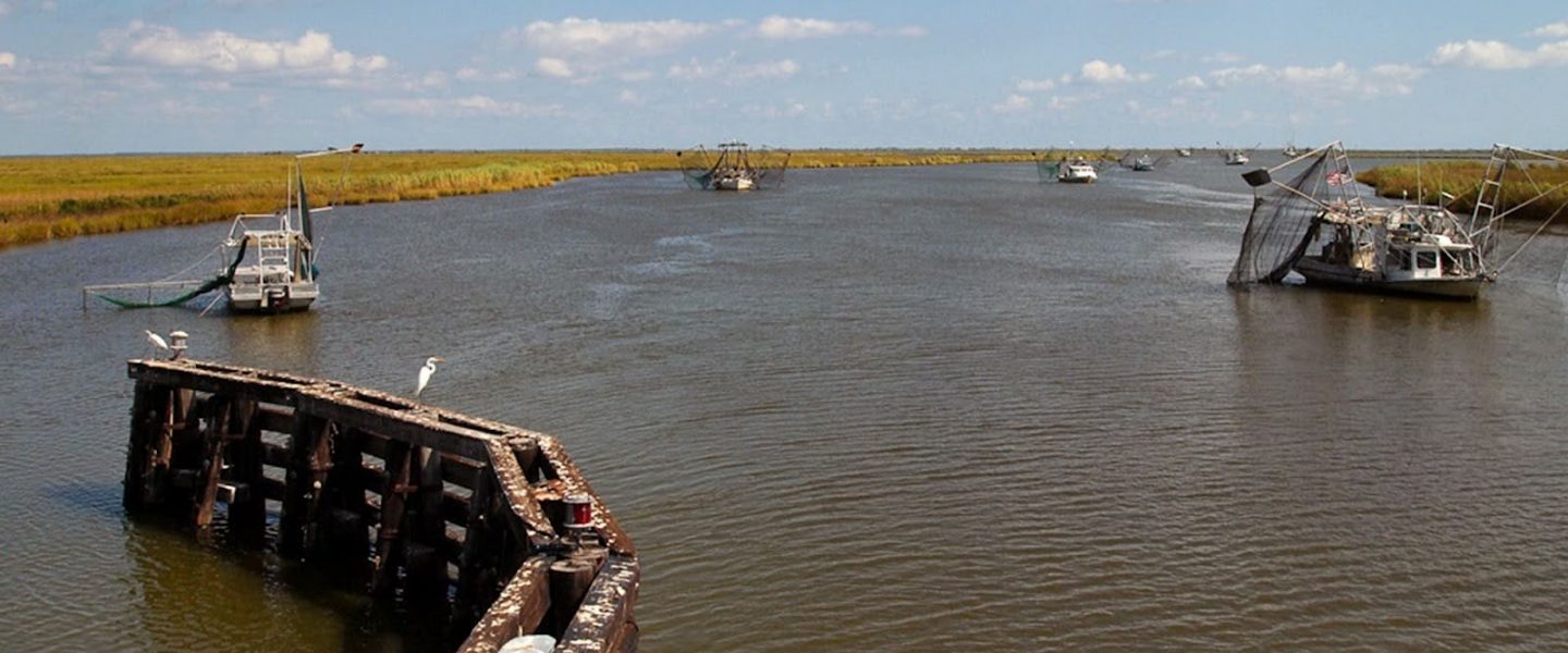
Today, GCDBCC members live in several small towns, often many miles from the lands granted to their ancestors. That’s because sinking land has inundated the once-solid ground they used to inhabit.
To determine the extent of the land loss, Parfait and his colleagues used a genealogical database created by tribal elders to identify land parcels allotted to the tribe in the 19th century.
Then, they compared the land on those parcels as depicted in an 1894 US Geological Survey map to the state of the parcels shown by satellite maps in 2020.
The analysis showed that many plots of land are now open water. Parfait said this is in line with what his community members have told him.
“They could not have stayed where they were, even if they’d wanted to.”
“Now, [the land parcels] are anywhere from 50%–90% underwater; they are not livable places,” said Rónadh Cox, a geologist at Williams College and an honorary member of the GCDBCC Tribe. The research team is still working to quantify exactly what percentage of land allotted to the tribe is now inundated.
The results demonstrate that the tribe could not remain in the federally allotted lands, Cox said. “They could not have stayed where they were, even if they’d wanted to.”
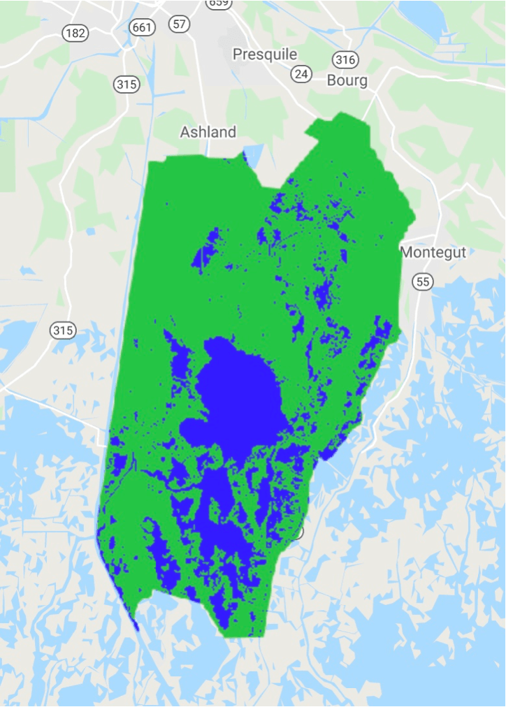

Since the 1980s, the Grand Caillou/Dulac Band of Biloxi Chitimacha Choctaw Tribe has lost 0.7% of their land per year as it converts to open water. Credit: Devon Parfait, Rónadh Cox, and Sampriya Roy.
Land in southern Louisiana is transitioning to open water for several reasons, Cox said. First, about 700 years ago, the changing flow of the Mississippi River shifted where sediment was deposited. The lands allotted to the GCDBCC Tribe no longer receive sediment from the river and are thus “fated to subside” as sediment compacts, she said.
Levees and dams on the Mississippi River and its tributaries built in the 20th century also led to a sediment deficit, according to research by Sam Bentley, a coastal and marine geologist at Louisiana State University who was not involved in Parfait’s research. Oil and gas operations, too, have accelerated subsidence in southern Louisiana, he said. As these resources are extracted, the volume of the sediment decreases, leading to land subsidence. And thousands of miles of canals built to service oil facilities have led to saltwater intrusion, which kills freshwater plants and causes erosion.
“The unintended consequences of river management and fluid extraction have created radical changes in the landscape,” Bentley explained. The new research uses a “creative” and “exciting” approach that blends historical knowledge, community knowledge, and rigorous analysis tools, he said.
The team is working to determine whether the placement of industrial facilities such as oil and gas extraction sites and canals correlates with higher land loss rates on Indigenous lands.
Petitioning for Recognition
Parfait hopes to include the findings in an upcoming petition to the Bureau of Indian Affairs (BIA) for federal recognition of the tribe. The tribe is acknowledged by the state, but federal recognition, he said, would open opportunities for resources and funding from government agencies.
“As the years have progressed, our ecosystems have become much more fragile and destroyed,” Parfait said. Accessing some of that funding would help the tribe implement their own visions of a sustainable community and coast.
But one BIA criterion for federal acknowledgment is documentation that the tribe comprises a “distinct community,” a benchmark tribes can meet by demonstrating that they reside in a distinct geographical area and have a persistent collective identity. Since land loss has forced tribal members to scatter around southern Louisiana, that criterion may be difficult to fulfill, according to Parfait and Cox.
But the results of the new analysis provide the BIA with a reason why the GCDBCC Tribe doesn’t have such a space, Parfait said. “I believe we have more than enough evidence to go for federal acknowledgment,” he said.
This story by Grace van Deelen was originally published by Eos Magazine and is part of Covering Climate Now, a global journalism collaboration strengthening coverage of the climate story.

