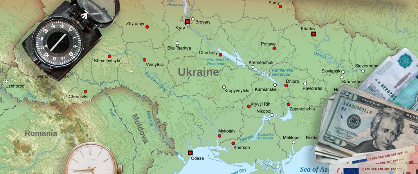
Maps can be powerful, especially if another country is trying to steal your territory. Borders are currently disputed in Crimea, Kashmir, Western Sahara, and the South China Sea. What the map shows in each case depends on who influences the cartographer and whether we are paying attention.
|
Listen To This Story
 |
Mykola Golubei is one of six million refugees who fled Ukraine. When he reached Poland, he tried at first to help other refugees get settled. He moved on to Germany to start a life for himself, but he missed his home in Ukraine.
“I had a nice life there before the war,” he said.
Golubei thought back to when he was six or seven years old and his father had bought him a map. In a moment of nostalgia, he went into a store and bought a map that showed his home country. To his surprise, even though the map was produced in Germany, Crimea was not shown as territory belonging to Ukraine. Golubei would have expected that in a map produced in Russia, but this was Germany. The United Nations still recognizes Ukraine’s borders as they were when Ukraine declared independence in 1991; why did a map produced in Germany display Crimea differently?
Golubei says he went back to the bookstore and began looking at other maps and atlases. Almost none of them showed Crimea as Ukrainian. The discovery launched Golubei on a research project to look into the impact that propaganda has on maps. He began buying road maps, globes, school atlases, wall maps, and anything else he could find online and in bookstores that defined Ukraine’s borders. In total, he has invested over €4,000 in the project.
Along the way, Golubei found that over 30 internationally respected companies from Germany, Switzerland, Austria, Great Britain, Italy, and the United States distribute maps in which the borders of Ukraine differ from those officially recognized by the UN.
Golubei thinks that the discrepancy represents more than an accidental oversight since Ukraine’s Geographical Society sent an appeal to the World Geographical Community immediately after Russia’s illegal annexation of Crimea, calling on all geographers to follow the UN resolution rejecting Russian claims to Crimea or Sevastopol.
Viacheslav Oleshchenko, the vice president of the Ukrainian Geographical Society, notes that the UN’s resolution was largely ignored. “Many companies now show maps of Ukraine incorrectly,” he says.
Golubei believes that Western maps that show Crimea as Russian or contested territory have been influenced by a not-so-subtle propaganda campaign initiated by the Kremlin.
Of course, Crimea is not the only area that appears differently on maps from around the world. Just as Russia has now made it illegal in Russia to refer to Crimea as part of Ukraine, India considers it a crime to show contested Kashmir as not being part of India, even though large parts of it are administered by Pakistan. Vietnam and the Philippines recently banned the movie Barbie because it allegedly showed a map of the nine-dash-line, which China uses to claim the entire South China Sea, including the coasts of Vietnam and the Philippines, as its national territory. The moviemakers said that what looked like a map was really supposed to represent doodling by a child and was not intended to make a political statement. Still, the incident highlighted the sensitive nature of these controversial boundaries.
For his part, Golubei believes that Western maps that show Crimea as Russian or contested territory have been influenced by a not-so-subtle propaganda campaign initiated by the Kremlin.
“If one map is wrong, it’s a mistake,” he said. “But if the biggest publishing houses of Europe and the USA show the territory of Ukraine incorrectly, it’s not a mistake, it’s a conscious decision.” Russia’s long-range objective, Golubei believes, is to gradually change public perception until everyone sees Crimea as legitimately contested or already Russian. Golubei calls the Russian strategy “mapaganda.” If Moscow succeeds in creating uncertainty over who has a right to Crimea, it could have an important impact when it comes time to negotiate a peace treaty and decide who gets what territory.
Golubei calls this “soft propaganda,” and he thinks that it can have an even more severe impact than “hard propaganda.” The hard approach — a nuclear threat against Berlin for instance — is easier to identify and reject than the soft approach that can be seen in altering the maps that show Crimea.
Golubei is not alone in considering the importance of maps in the Kremlin’s propaganda efforts.
“Russia has been very active in advancing the idea that the annexation of Crimea was a legitimate move,” says Anton Shekhovtsov, a Ukrainian political scientist. “That they criminalized it means that they are taking these maps very seriously.”
To a certain extent the campaign seems to be working. Golubei notes that America’s National Geographic Society over time has shown at least five different versions of Crimea’s borders on its maps. The maps either portray Ukraine according to the internationally recognized borders of 1991, depict Crimea within Ukraine’s borders but with a different fill color, mark Crimea as a disputed territory in gray, or show Crimea as part of the Russian Federation. Golubei even found one map listing Crimea’s border as “claimed by Ukraine.”

Golubei believes that the Kremlin is following a propaganda strategy best described by the concept of the Overton window. The idea is gradually to introduce microchanges into the public perception until everyone looks at the altered definition of reality as an accepted fact.
It’s doubtful that Western mapmakers intended to follow the Kremlin’s line concerning Crimea, but the American Geographical Society’s CEO, John Konarski, points out that maps always contain a viewpoint. “In geography, decisions have to be made on how to look at borders,” he said, “and these decisions are shaped by the cartographer’s view of the world.”
Juan José Valdés, the official geographer of the National Geographic Society, claims that National Geographic maps are apolitical, but in an interview with U.S. News, he admitted that “we map the world as it is, not as people would like it to be.”
Guntram Herb, who teaches geography at Middlebury College, sees dealing with controversial borders as a particularly tricky problem. “If you write something, you can give different viewpoints,” he says. “If you draw a line on a map, the line is there.”
Herb says he teaches his students to always read maps critically. “There certainly are not a lot of people who are map-literate,” he says. When looking at maps, one has to be aware of their limitations.
Herb agonized over the problem himself when working on maps with disputed borders. “I had long discussions with my team,” he says. “What do we do with Crimea? What do we do with Western Sahara?”
Herb says his team decided to go with the UN’s resolution. Other geographers choose different points of reference. The American Geographical Society for instance chooses to follow the US State Department’s lead when it comes to interpreting maps.
The CIA World Factbook, a generally respected reference in use around the world, also reflects the political thinking in Washington when there are controversies over who owns what. Morocco claims the Western Sahara even though the UN recognizes it as an independent territory. In 2021, then-President Donald Trump decided to ignore the UN and side with Morocco. The CIA’s World Factbook now lists the Western Sahara as part of Morocco.
Golubei wants to prevent the same fate happening to Crimea.
“Where they have not yet been successful and I hope they will not be successful is Western political decision-making,” said Shekhovtsov. Because Western decision-makers have not yet changed their course on support for Ukraine, “at least at the moment the Russians have not achieved their objectives yet.”
To keep it that way, Golubei is determined to put pressure on the publishers that he has identified as following the Russian line. The goal is to put an end to the distribution of maps influenced by Russian claims to Crimea. He calls his project “Stop Mapaganda.”
Next to social media pressure, sanctions, and collaborating with the government level, he also wants to take his case to court. He is demanding that errant publishers stop distributing propagandistic materials, send clarification letters to all customers, and conduct an open internal investigation so that the people involved in distributing false maps will take responsibility for their actions.


