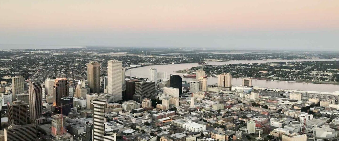
Parts of New Orleans Are Sinking
Areas near the airport, along floodwalls, and in nearby wetlands are subsiding because of a combination of natural and anthropogenic forces.
|
Listen To This Story
 |
Parts of Greater New Orleans are sinking by millimeters per year, increasing their vulnerability to floods and storm surges.
Though most of the city is stable, areas near the Louis Armstrong New Orleans International Airport, sections of flood protection walls, and certain industrial sites and wetlands are losing elevation, researchers reported in Science Advances earlier this summer. The rate and scale of these losses vary because rates of subsidence are affected by multiple factors, including groundwater pumping, wetland drainage, construction and urban development, and natural soil compaction.
Flood protection infrastructure put in place in the months and years following Hurricane Katrina in 2005 could lose effectiveness more quickly than expected.
Coupled with rising sea levels, the rapid subsidence could mean that without regular upgrades, flood protection infrastructure put in place in the months and years following Hurricane Katrina in 2005 could lose effectiveness more quickly than expected.
Spotting Subsidence from Above
As part of the new research, remote sensing expert Simone Fiaschi and his colleagues used interferometric synthetic aperture radar, or InSAR, to map subsidence across the city in 2002-2007 and 2016-2020. InSAR measures the distance between a satellite orbiting Earth and the planet’s surface. When averaged over measurements taken at different times, the satellite data can be used to detect millimeter-scale changes in elevation.
Knowing where and how quickly subsidence is occurring can clue scientists in to potential causes, said Fiaschi, who now works at the InSAR company TRE ALTAMIRA. “And that’s, of course, necessary if you want to intervene or … make adjustments to protect the city.”
During both periods, research showed that much of Greater New Orleans was stable, sinking or rising by less than 2 millimeters per year.
But a few hot spots revealed larger changes. For example, the area in and around the Louis Armstrong International Airport sank by up to 27 millimeters per year between 2016 and 2020, likely because of construction of a new terminal during that time.
Areas of concrete floodwall near the airport and along sections of the Mississippi River, built as part of the city’s $15 billion Hurricane and Storm Damage Risk Reduction System, also sank by more than 10 millimeters per year as the floodwalls settled.
Identifying Problem Areas
About half of New Orleans is already below sea level; even a small change in elevation raises the risk of flooding.
The city’s infrastructure may already be showing the effects of subsidence, said Krista Jankowski, a geoscientist at the consulting firm Arcadis who lives in New Orleans but did not participate in the new research. Filled potholes become artificial high spots as the land around them continues to sink, and fire hydrant collars that used to be level with surrounding lawns now sit several inches higher.
Wetlands within and beyond the floodwalls are sinking, too. Both natural erosion and human-driven water removal could be contributing to this subsidence.
“It’s an existential consideration for people who live in New Orleans.”
Other areas are even gaining elevation in response to human activity — or lack thereof. The Michoud neighborhood, in the city’s Ninth Ward, rose by up to 6 millimeters per year between 2016 and 2020. Until 2016, groundwater extraction by a local power plant caused Michoud to sink. But when the plant was decommissioned and pumping stopped in 2016, the water table started to recover and the land began to rebound. That finding showed that at least some of the subsidence can be fixed.
“I think that’s a nice aspect of the study, that it updates earlier studies and documents what parts have been fixed and what parts are still a problem,” said Tim Dixon, a geologist at the University of South Florida who was not involved in the new research.
Monitoring and managing subsidence is “an existential consideration for people who live in New Orleans,” Jankowski said. Having a better understanding of where subsidence is concentrated and how quickly those areas are sinking, she explained, will help “make sure we’re paying attention to places where there may be issues.”
This story by Skyler Ware was originally published by Eos Magazine and is part of Covering Climate Now, a global journalism collaboration strengthening coverage of the climate story. WhoWhatWhy has been a partner in Covering Climate Now since its inception in 2019.
![]()


